Sunday, September 19, 2010

Day 63 - (09/19) Fortuna, CA ... day 2

Today we toured by taking the National Geographic Lost Coast and Avenue of the Giants scenic drives.  The Lost Coast drive starts in Ferndale, just north of Fortuna.


We saw this unusual scene while crossing the Eel River on the way to Ferndale. 
This SUV was moving when we first saw it, then the front-end sunk deeper.


Ferndale is an 1852 town that grew rich from creameries and enjoyed a boom in Victorian houses.  It's an attractive, small town full of Victorian-style homes and businesses.  The community has obviously committed to care of their properties.  Most were very well maintained.  Here are some examples.
Main street, downtown
One of many on the main street
The Shaw House, built in 1852
The Gingerbread Mansion is one block off the main street
This one is on a corner opposite
 The Gingerbread Mansion
Downtown Hotel
Lost Coast scenic drive starts on Mattole Road in Ferndale.  The entrance sign is totally out of character with the drive itself.  The road is 2-lane (single lane in some places), very curvy, with steep ascents and descents.  It's poorly maintained.  But ... it offered spectacular views and took us to one of the westernmost points in the contiguous 48 states.
Fancy sign to very small places
Moss-covered trees as we zigzagged out of town
Forested valleys and grassy hills
 as we approach Wildcat Ridge
View of the road as we approach Capetown
(Note the curves and switch-back)
We passed many bike riders
(We think they were in some kind of club outing)
The red structure below is a ranch in Capetown.
(It was a former stage stop)
We finally drop down to Cape Mendocino.
Cape Mendocino shoreline
Cape Mendocino - looking south
Cape Mendocino - looking north

The Lost Coast route went through Petrolia and entered the Humboldt Redwoods State Park (after a lot of sharp turns, climbs and descents).  The road passed through groves of huge redwoods.  The views were remarkable.
Humboldt Redwoods State Park
This is the only way to see the tree tops
They cut huge path "doorways" through fallen trees
The Rockefeller Redwood Forest is part
of the Humboldt Redwoods State Park.
Carol at the Flat Iron Tree
(Fell in 1995, oval circumference is 17.5' x 7.5')
Carol at the Giant Tree
Arched trunk on Avenue of the Giants
Avenue of the Giants stretches for 31 miles

This was a delightful day filled with new sights.  Driving the Lost Coast route was tiring.  It's a good thing we didn't try it with the trailer attached.  We had clouds, fog, rain and sun ... and each appeared or disappeared when needed.

We had dinner at the Eel River Brewery Company.  Their taco salad is great!

Carol met a young man who was riding a bicycle from Seattle to Miami while she was doing laundry.  He's been on the road for nearly 3 weeks and expects to get to Miami by February.

Map Tracks
None for today.

Saturday, September 18, 2010

Day 62 - (09/18) Fortuna, CA ... day 1

The rain continued all night and for most of the day today.  We decided to head down to California (it's only 5 miles from Brookings).  We connected up in a steady downpour and got on the road by 11am.


Our route went through Crescent City, Klamath, Trinidad, and Eureka.  We drove through the Redwoods National Park.
Redwoods along US-101


We stopped at Riverwalk RV Park in Fortuna, CA.  Things are looking up.  We're in a wonderful campground with the highest Woodall's rating.  And ... the rain stopped just long enough for us to set up the trailer without getting wet.

The campground staff recommended The Eel River Brewery Company for dinner.  We had excellent fish and chips.  We saw this encouraging view of blue sky when we left the restaurant.
This blue sky offered hope for better weather tomorrow.
Site 44 at Riverwalk RV Park


We'll stay in this park tomorrow and take a driving tour through the redwoods.                              
Map Tracks
Start:  Driftwood RV Park - Brookings, Oregon
South on US-101 to Fortuna, California
End: 129 miles @ Riverwalk RV Park - Fortuna, California

Day 61 - (09/17) Brookings, OR ... day 2

We hoped to get some of yesterday's missed photo-ops today.  The weather changed our plan. It started to rain early in the morning.  It continued all day and throughout the night.


We decided to stay an extra day in Brookings and do some exploring.  


We drove north to Gold Beach and went to the Curry County Museum.  It's a very nice little museum with helpful volunteers.  


Next, we went to Rollin N Dough Pastries for lunch.  It's located across the bridge from Gold Beach, in Wedderburn.  It's a small, very good, casual gourmet restaurant.  All tables were taken; a couple from San Diego invited us to join them at their table.  We had a delicious lunch and delightful conversation.  Carol had her first fish taco.


We stopped at a myrtlewood factory in Gold Beach.  The owner explained the process.  It was very interesting to watch them turn a bowl and see the beautiful finished bowls and platters they produce.  There are only nine myrtlewood factories in the country.


We stopped at several viewpoints on the way back to the trailer.  The scenes would have been gorgeous without the rain and fog.  Here's what we could get ...


Sea stacks outside Gold Beach
View near Pistol River
Samuel Boardman State Scenic Overlook

We had scrambled eggs, toast and Kenny's homemade jam for dinner.

It rained steadily all day.  Here's hoping the weather improves tomorrow.

Map Tracks
None for today

Day 60 - (09/16) Brookings, OR ... day 1

This morning we did some exploring and caught up on pictures missed yesterday.  We headed south after noon.

The Tugman campground was very nice.  Here are a few pictures of a great place to stay.  
Park entrance ... on US-101, south of Winchester Bay
Continuing into the campground
This park and picnic ground are located between the campground and Eel Lake
We drove north to Reedsport and stopped at the Oregon Dunes Information Center.  They offered excellent tour guidance, presented a video describing the history of the dunes, and recommended a place for great cinnamon rolls.  Note:  The Sugar Shack Bakery has a wide selection of pastries.  The few we sampled were good, but didn't make our top 3 list for the trip.
A place for sweets in Reedsport


From Reedsport, we drove further north to The Oregon Dunes Day-Use Area.  The Oregon dunes are not a sea of pure sand but a  blend of open dunes, tree islands, wetlands, forests, and lakes.  The dunes stretch for 40 miles along the coast and are managed by the US Forest Service.  The on-site rangers were very helpful.
Zach gave us great dune tour/hike guidance for a cold, windy day
Carol gets a dune view from the overlook
You can look across waves of sand that reach several hundred feet
Carol considers a leap into the sand
People sure looked small from the overlook
Carol heads down
The wind was cold and blowing strong enough to keep the sand in motion.
View of the dunes from the return path
The route south took us through North Bend, Coos Bay, Bandon, Port Orford, and Gold Beach.  We stopped in Brookings.  The coastline changed dramatically as we went from the Central to Southern Oregon Coast region.  There were expansive sand beaches, dunes, sea cliffs, pocket coves, sea-stacks and wind-twisted trees.  It was a beautiful drive ... one minute we were shrouded in clouds and the next minute the sky was blue.
Conde McCullough Bridge spans entrance to Coos Bay
Port Orford dock
Sea stacks - south of Port Orford

Coast pictures ended when we got to Gold Beach ... the camera battery died.  We made notes of places to revisit if possible.

We camped at the Driftwood RV Park in Brookings.  It's a nice park located across the street from  the marina.  There's no landscaping (think asphalt and gravel), but all of the services worked fine.

Map Tracks
Start:  Tugman State Park - Winchester, Oregon 
South on US-101 to Brookings, Oregon
End: 130 miles @ Driftwood RV Park - Brookings, OR

Thursday, September 16, 2010

Day 59 - (09/15) Winchester Bay, OR

Today was a combination of exploring and travelling.  We didn't have to check out of the state park until 1pm, so we started by taking a second look at the beach, jetty and bay hidden by fog yesterday.  
Carol's bear is bewildered by our plan for the day.
Here's a fresh look at the tree tunnel to the beach.
South Beach without fog
South Beach is wide, long and very clean.
Gull in flight and fog bank on the horizon.
US-101 crosses this bridge at entrance to Yaquina Bay in Newport
After confirming that the Pacific Ocean and the beach were really there, we hooked-up and headed south.  US-101 gave us wonderful views of the coast.  Constant winds off the ocean have styled the trees and brush; they look like teased hairdos. 


Wind-swept cedars.
Natural wonders appear all along the route.  We saw this Spouting Horn at Crooks Creek.  The tide was out; there was no plume action.
Description of the Spouting Horn
This converging channel causes the spout.
It started to rain when we were at the spouting horn.  Carol spotted this 18" mushroom during the climb up from the shoreline.
Huge mushroom hidden in the underbrush.
We tried to stop at Cape Perpetua and Devil's Churn but had to skip them.  The parking area was very small and the two RV spaces were occupied.  We parked at the Cape Perpetua Visitor Center for lunch.


Many wonderful sights appeared as we continued south.  We captured some and missed many because of intermittent rain or no place to pull off the road.  Here are a few.
Central Oregon coast from US-101
We camped at Tugman State Park a few miles south of Winchester Bay.  It's a beautiful campground with large, private sites.  We had water and electric service.  The site was cleaned and raked before we arrived.  They had rest rooms, showers, a dump station and a recycling center.  All for $20 per day.
Site C-1 at Tugman State Park
After getting set up, we drove to the Umpqua Lighthouse State Park campground to see what we missed (it was full when we called earlier in the day).  Thank you Umpqua campers ... Tugman is much nicer and less expensive.


We had dinner at Bedrock on the Bay in Winchester Bay.  Their clam chowder in a sourdough bread bowl was excellent.


Winchester Bay is a fishing community.  It was interesting to drive around the marina, through the small business district and past some of the residences.


Map Tracks
Start:  South Beach State Park - Newport, Oregon
South on US-101 to Winchester Bay
End:  80 miles @ Tugman State Park - Winchester Bay, Oregon

Day 58 - (09/14) Newport, OR

We said goodbye to our Portland family and hit the road again at 9:15am.  It was overcast most of the day.  The sky cleared occasionally as we climbed to higher elevations near the coast.
We saw a lot of this before noon.

We stopped at the Blacktail Café in Cloverdale for lunch (see Day 38 on 8/25 for our first experience there).  This time was like stopping to see an old friend.  We talked with the owner’s mother and received some travel tips from another customer.  The server remembered us, the meal was delicious … and the service was still slow.  Try the pies if you ever stop here.  Carol had strawberry-rhubarb; Dick had apple.  We shared a single scoop of Tillamook vanilla ice cream (so it doesn’t count, right?).

We camped at South Beach State Park just south of Newport, OR.  It's right on the ocean and very nice.  Oregon has an outstanding park system and this is another example.
The camp site is large.  The path to the beach is right behind us.
This path is close and inviting.
A fog bank rolled in late in the afternoon.  Visibility quickly dropped to nil, but we continued to explore paths to the beach and jetty.  We saw little bits of the jetty and none of the beach.  Here's some of the journey.  
The path led us through this tunnel of trees.
(Notice: there is some light at the end of the tunnel)
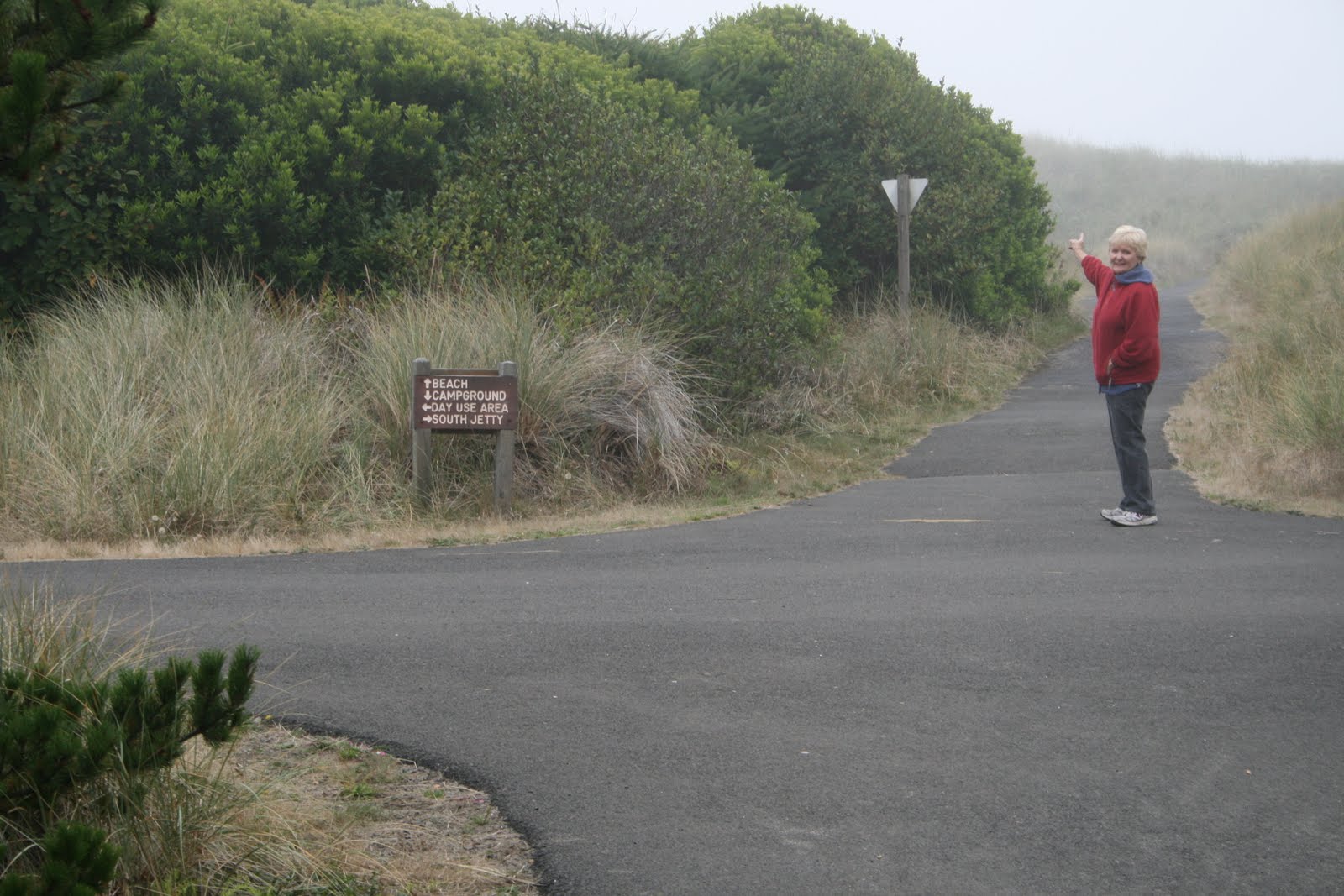
Carol points the way at the jetty/beach path intersection.
(Notice: the fog is getting thicker.)
The path leads over the dunes and through the grass.
(There is an ocean over the hill, but we never see it.)
We saw a starfish on the jetty.
This is about all we saw of the Pacific Ocean.
(On a clear day we could see ...?)
After looking hard and seeing little, we decided to go to Newport for groceries.  Then we had dinner at The Chalet Pie Shop in Newport ... clam chowder and no pie (honest).


Carol was struggling with lingering flu symptoms, so we went to bed early.  Hopefully, we'll get a better view of our surroundings tomorrow.


Map Tracks
Start: Portland, Oregon
West on US-26 to OR-6
West on OR-6 to US-101 at Tillamook
South on US-101 to Newport, Oregon
End: 154 miles @ South Beach State Park - Newport, Oregon